Kortezwaag The Leijen
Kortezwaag was mentioned as an independent village as early as 1315. The chapel list from 1315 states that a chapel was present. Kortezwaag was originally a farming village. In the first mention the place was called Urasuagh. The name part Ura shows that it was situated higher than Langezwaag, then called Utrasuagh. The name part "suagh" indicates pasture(s) where cattle were kept. In 1496 the place name was written as 'die Corte Swaech' and in 1505 as 'Corteszwaege'.

Oud-Kortezwaag consisted of the medieval residential site. This was the area around the church up to Dekemastate. Jong-Kortezwaag probably arose from about 1600 on the territory of sathe 1, the Vogelsang sathe, also called Veenherensathe. This was the time of the great peat extraction. From this a gebuurte arose on the southwest side of the Compagnonsvaart. This eastern part of Kortezwaag later became the hamlet of Oosterend.
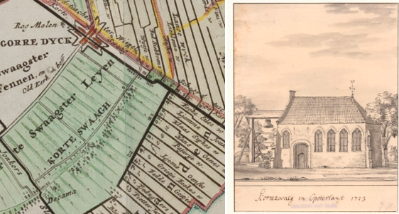
The settlement around the church was probably not the first in the area. Before that the Kortezwaagsters possibly lived in the Kortezwaagster "fins". Because the sea level was lower, people could still live on these parts. Later these low-lying grasslands flooded. People were forced to live higher up, behind what would later become known as the 'olde dyck'. However, this flood barrier could not last for centuries either. The settlement was therefore moved to the vicinity of where St. Mary's Church was founded. Here a chapel was built in the Middle Ages in honor of Mary. This chapel survived the Reformation and received stained glass windows in 1649. The chapel was depicted in 1723 by Jacobus Stellingwerff as a Gothic church with bell tower. The Hogedijk was further raised to have sufficient safety from the outside water. To also be protected from the water on the higher peat lands, the farmers also built a leidijk. This must have been approximately at the place where later the Dwersfeart was and now the road to manege Dekema is.
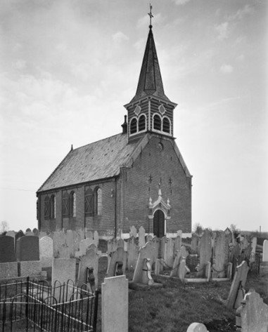
By the end of the eighteenth century, the old church building had become a ruin. This was possibly caused by the peaty soil. The present church was built in 1797. It was a hall church without a tower. In 1896 there was a major rebuilding and a tower was built. The municipality helped pay for this. The national monumental church (state number 31852) is located on a small elevation, surrounded by a beautifully landscaped cemetery. Currently, the church is owned by Stichting Alde Fryske Tsjerken. In the church floor there are no traces of burials in the church itself. Under the pulpit, however, there are remains of a sarcophagus lid from the Middle Ages. The crosses on the lid show that it was also used as an altar stone.
Municipal cemetery De Leijen Kortezwaag
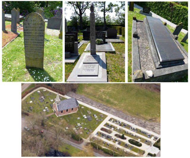
Kortezwaag's municipal cemetery surrounds the eighteenth-century Maria Church, which is located on a mound. The cemetery has three sections. The "old part" and the two extensions. The old part lies directly around the church building. The oldest stones in the churchyard come from 1770 and 1773. The plot was slightly larger than 2,400 m² around 1830. The belfry in the churchyard was torn down in 1896. New graves were then made on this site. The bell is now in the clock museum in Asten, North Brabant.
In 1938 the Reformed congregation of Kortezwaag consulted on an expansion and the construction of a new cemetery. Expansion behind the cemetery was then the most logical choice. In October 1939 this was started. The work on the cemetery was carried out in the work supply. It was a strip behind the old cemetery. Eight long rows of graves were laid out, all along paths. A wide strip was left free in the middle. The first person to be buried in this section was Private Joachim Wijnstra, who was killed at Ridderkerk in 1940.
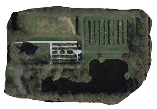
In 1964, the municipality received the plan to expand the Kortezwaag cemetery by 1,200 graves. To implement this plan, 2.5 acres of land were needed. A long, narrow section was laid out on the north side with a shorter, wider section behind it. To raise these sections, a pond was excavated on the south side and a small pond was planned on the north side for sand extraction. A special part of the design was the inclusion of an urn garden. Fryslân did not get its first crematorium until 1973.
In February 1969, the City Council agreed to take over the cemetery. A sum of 256,000 guilders was made available for the expansion. In 1970, the second expansion was commissioned by the Municipal Works of the Opsterland municipality (section D and children's section). A grave field with space for 720 graves and an urn wall were added. In 1978, a scatter field was constructed. In 2010, space was made for urn graves. The current situation of the scattering field is still at the back of the grounds, as in the old design.
Location in the landscape
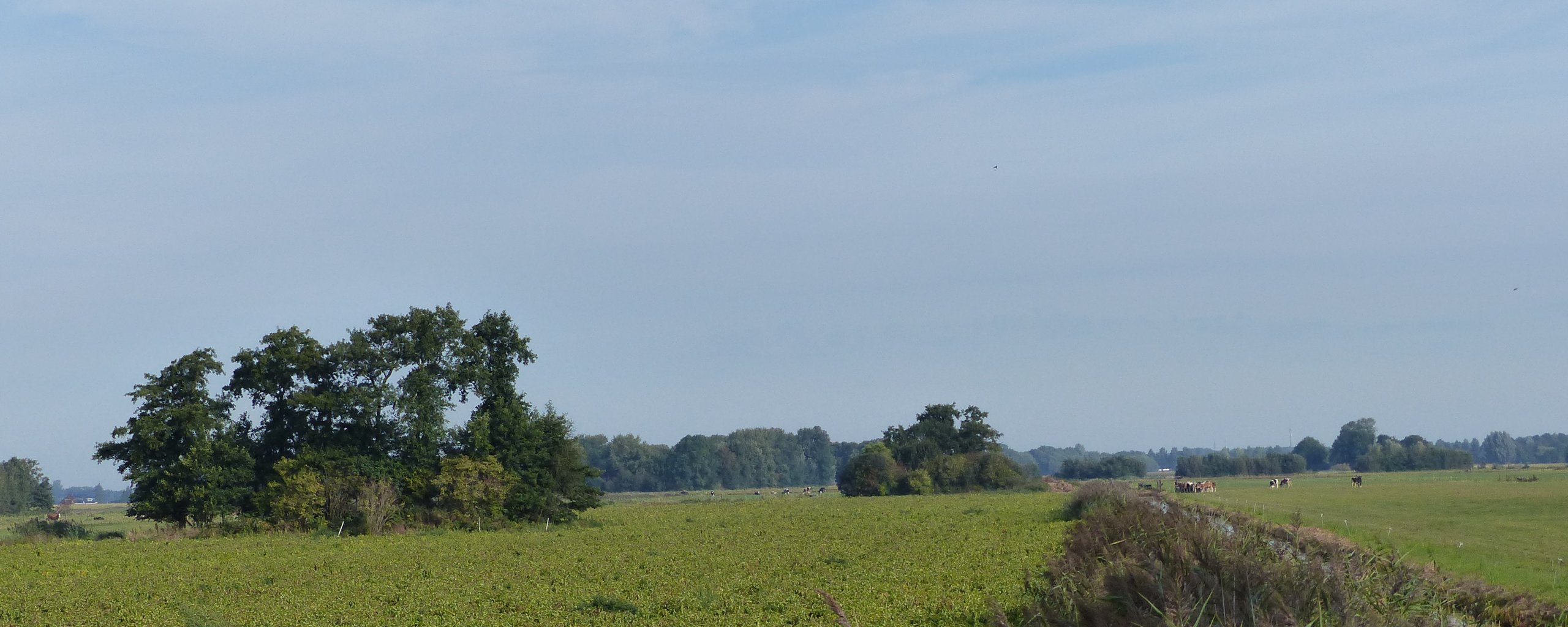
The church, as mentioned, is located on a somewhat higher part. Church and churchyard were for centuries part of a long strip of houses that formed Kortezwaag. The street on which church and churchyard lie used to be called the Lijkweg. Opposite the church ran the Kerklaan, but this has disappeared. Around 1830 there were still few houses. Behind the church there were a few simple houses and a farm. These disappeared when expansion took place.
Due to several expansions, the grounds now cover nearly 3 acres, 1.3 acres of which are used for burials. In front of the church is a parking lot, which gives an open view of the church. In the Zoning Ordinance Rural Area, the site is zoned "Cemetery." Small plots around it are zoned for residential or agricultural use.
Construction and green aspects.
The different parts of the cemetery each have their own atmosphere. Especially for the last extension, a lot of energy was put into the planting, which can still be seen. On the old part, only a beech hedge is significant. This is present along the parking lot, De Leijen and the northeast side of the cemetery. The churchyard itself has no planting. Important image-defining element is the elevated position of the churchyard and all the grave monuments standing or lying in the grass.
The first extension was given a greener layout than the old section around the church. There are three public gardens between four rows of graves. They have low plantings and some smaller trees. The graves are in the grass. A yew hedge is planted at the end. Along the path to the last extension are shrubs and trees. The planting is typical of the 1960s. The yew hedges between the graves are also typical of that time. There are shrubs like snowball, buckthorn, many-flowered rose and dwarf medlar with oaks, rough birch and black alder in between. Near the ponds, willow and rowan were chosen. There are also oak trees along the avenues. These plantings fit well with the soil type. Some of the low plantings were replaced at a later date by rhododendron, among others.
Meanwhile, new trees have also been planted in various locations. More use has been made of beech hedges, such as at the urn garden. The various plants chosen for the expansion are now no longer present. Maintenance standards were adjusted and sometimes they did not grow well. The amount of yew planted then is still there, but is dead in some places. Shrubs and trees grew naturally in the girth. The purpose of the girth was to keep from being seen. This is still the case, but in some places open areas can be seen.
The cemetery provides a good example of the development of green aspects in cemeteries in general. From a simple construction with only greenery in the border on the old piece, to the use of greenery to enhance sightlines, to keep the image inward and to give privacy to visitors.
Typology of grave monuments
As mentioned above, three parts can be distinguished in the cemetery, which can also be seen in the grave monuments present. In the old cemetery around the church, the burial culture is nineteenth-century with hardstone grave monuments in a Frisian style, with palmettes, palm branches and weeping trees. There are also several pocket-sized monuments, some already made of granite, which show that this part of the cemetery was still in use well into the twentieth century. There are also recent burials.
In the first extension, the tombstones are similar to those in the cemetery. However, lower headstones are more often used here, made of granite and a more businesslike style. Many grave monuments here have a border around the grave which in some is filled with tiles or have a cover plate. The second extension shows the grave culture that is typical especially in the late twentieth century and early this century. Low, wide headstones made of various types of granite, in some cases over several graves, with a cover plate over the grave. Some grave monuments are a very personal choice. Some grave monuments are special because of the material used, design or symbols. Several sidewalk or boundary posts have also been used as grave monuments in the cemetery. Newspaper reports show that all kinds of local acquaintances are buried at Kortezwaag, such as Alderman Rindert van Zinderen Bakker (deceased 1927) and lawyer W. Jonkers (deceased 1928). These well-known persons are directly connected with the history of Kortezwaag and Gorredijk. The extension also contains several interesting grave monuments and a grave drum.
The Kortezwaag cemetery shows how a medieval churchyard developed into a modern cemetery. That the three different types of sections of the cemetery are still intact is special. Old elements are often modified or removed, but that has not been done here. The planting plan from the 1960s has been modified, but not in a negative way. Some older elements, such as the mortuary that probably stood there and the termination of the cemetery on the north and east sides, no longer exist.